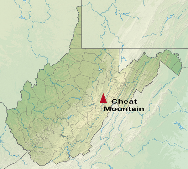
Cheat Mountain traverses the entire length of central Randolph County, West Virginia, from a northern point just west of Parsons to a southern point about 5.5 miles (8.9 km) south of the Randolph/Pocahontas county line, near the community of Stony Bottom, where it impinges upon Back Allegheny Mountain. All but the northernmost 4 miles (6.4 km) and the southernmost 5.5 miles (8.9 km) are within Randolph County. The western flank of Cheat Mountain is skirted by U.S. Route 219 which connects a string of communities in the Tygart River Valley (notably, from north to south, Montrose, Kerens, Elkins, Beverly, Huttonsville and Valley Head). The eastern flank, overlooking the valley of Shavers Fork, is more remote. Cheat Mountain is crossed (east/west) by two federal highways: U.S. Route 33 in its northern third and U.S. Route 250 in its southern third.
The Cheat River, a tributary of the Monongahela, is formed at Parsons, just east of the northern tip of Cheat Mountain, by the confluence of Shavers Fork and Black Fork.